According to the 2020 census, the smallest town in Montana is Ismay, with a population of 17 people.
But Ismay isn’t alone. Montana has more than twenty tiny towns hidden across the state, each with a population of less than 200.
Montana’s smallest towns can be found in the dense forests of the Rocky Mountains, in the open prairie of the arid Great Plains, and everywhere in between. If you happen to pass through one of them, blink and you’ll miss it.
While Montana is known for its many small towns, it’s hard to imagine just how small some of Montana’s towns are. Read on for a list of the 15 smallest towns in Montana, each one steeped in a unique history and teeming with charm.
15 smallest towns in Montana
Find Montana’s 15 smallest towns on the map:
Table of contents:
- Ismay
- Neihart
- Flaxville
- Opheim
- Rexford
- Outlook
- Bearcreek
- Grass Range
- Judith Gap
- Dodson
- Melstone
- Hingham
- Lavina
- Broadview
- Kevin
1. Ismay (the smallest town in Montana)
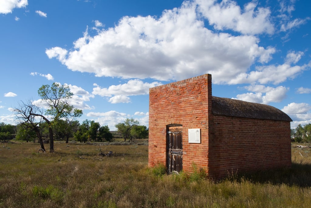
Population: 17
Ismay is the smallest town in Montana, with a population of 17 people occupying 0.42 miles2 (1.09 km2) of land in Custer County, Montana. Established in 1995, Ismay represents the historic settlement of, and exodus from, the northern Great Plains of Montana. The town features a post office, church, and no other businesses.
Ismay’s population has fluctuated since its founding, reaching 26 in the 2000 census, though its wane to 17 people in recent years has earned it the title of Montana’s smallest town. The name Ismay is a combination of the names Isabella and May, who were the daughters of prominent railroad tycoon, Albert J Earline.
Ismay is located in a remote region of eastern Montana. If you visit Ismay, this town puts you right in the middle of the rolling, golden hills and open spaces of the Northern Great Plains.
Did you know? Ismay is one of the top locations for UFO sightings in Montana.
2. Neihart
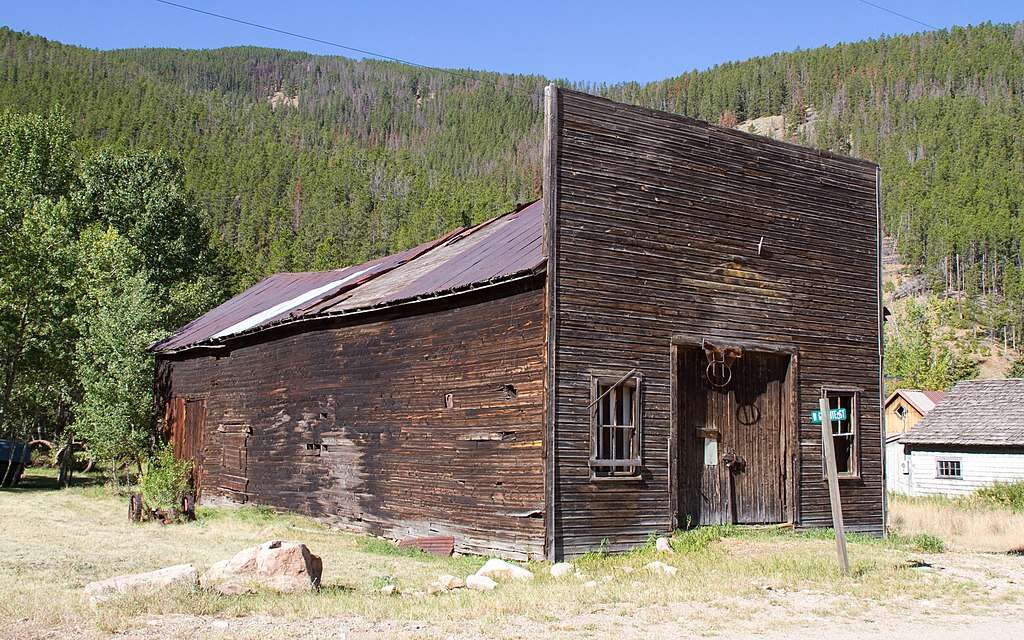
Population: 43
Neihart is a piece of living Montana history. You’re unlikely to find anything about Neihart in a Montana travel guidebook, or even on a list of Montana’s top ghost towns. However, Neihart was a booming Montana mining town throughout the 19th and 20th centuries.
When the minerals dried up, Neihart was nearly abandoned in the late 1800s, but when the Montana Central Railway reached the town in 1891, the town burst into life once again.
Various ghost town remnants from Montana’s mining days can be found on the outskirts of Neihart. Today, Neihart occupies just 1.99 miles2 (5.15 km2) of land in Cascade County, in the Little Belt Mountains, and has a population of 43.
Did you know? Neihart lies on the Kings Hill Scenic Byway, one of the most beautiful scenic drives in Montana.
3. Flaxville
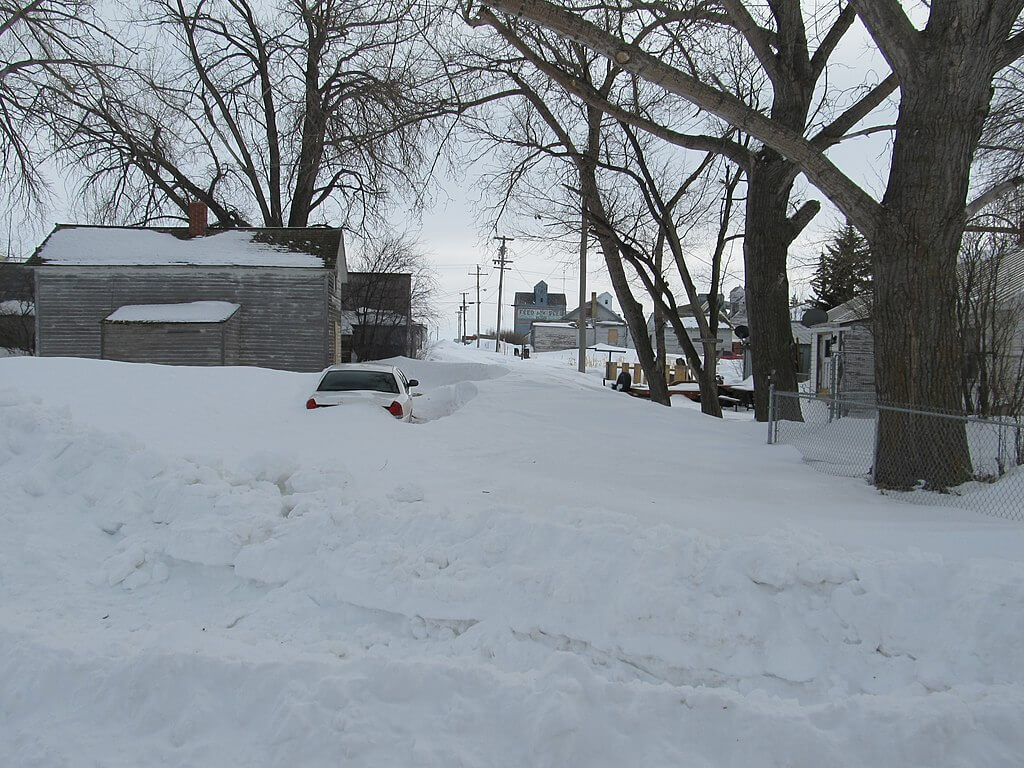
Population: 63
Flaxville occupies a unique place in Montana history, tucked up near the Canadian border, just north of the Fort Peck Indian Reservation in northeast Montana.
The town of Flaxville was originally called Boyer when it was founded, and it lay 2.5 miles (4 km) southwest of Flaxville’s current location. The current town of Flaxville was established in 1913, and the name derives from the large amounts of flax grown in the region.
Flaxville also lies along the K-Y Trail, which follows Highway 511 from Flaxville up to Canada. This is a historic trail for the local Native American tribes, who follow it to the turtle effigy in Saskatchewan, where they conduct sweat lodges and other religious ceremonies.
Flaxville occupies a 0.10 miles2 (0.26 km2) piece of land in this remote and beautiful region of Montana. Although there aren’t many sites or entertainment options in the town, it’s well worth stopping to stretch your legs and have a look around if you happen to be passing through.
4. Opheim
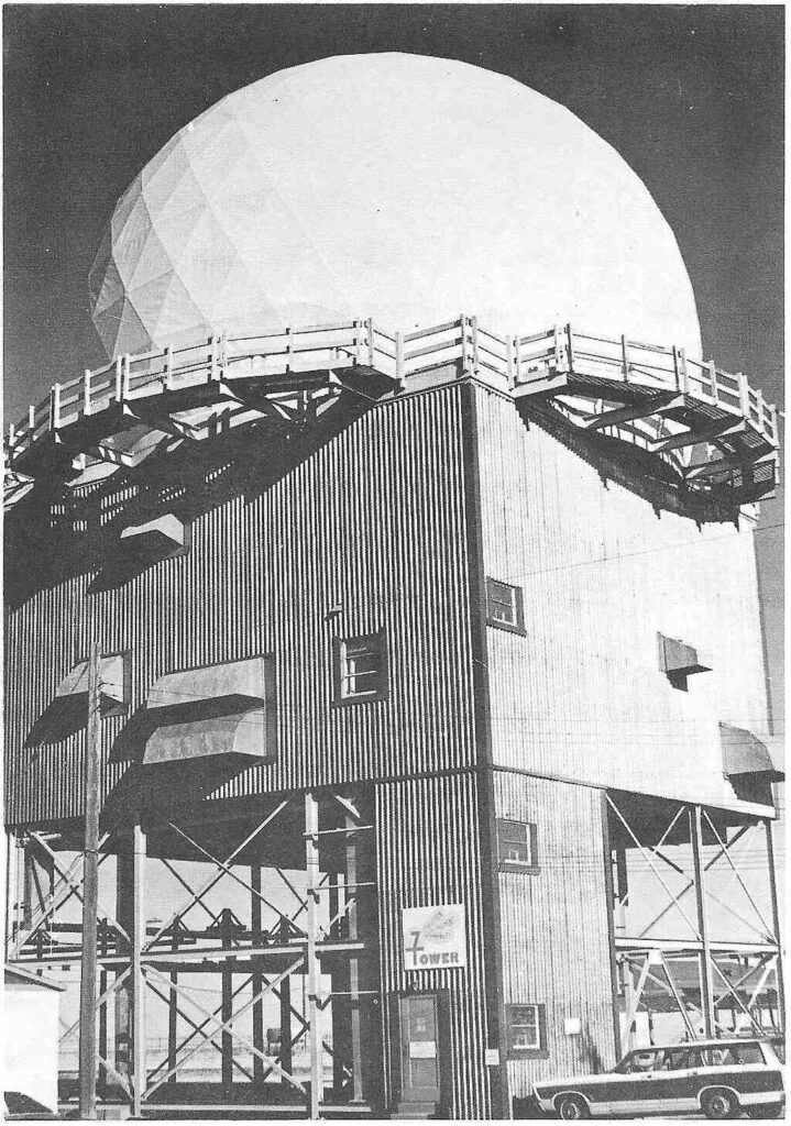
Population: 75
Opheim is a living testament to Norwegian history in northeastern Montana. Although this tiny Montana town has only 75 residents, it was once a flourishing town of 3,000.
Opheim’s heydeys were in the late 19th century. The town was founded before the Great Northern Railway reached the area, but when the railroad finally reached Opheim, and the town got its own depot, it experienced a boom.
Today, its Norwegian heritage is reflected by the Opheim High School mascot, the Vikings. Granrud’s Lefse, a bakery in Opheim, still serves traditional Norwegian flatbread called Lefse.
Opheim has been slowly shrinking since the early 20th century, a trend that accelerated in 1974 when the local Opheim Airforce Station closed its doors. Today, the town occupies just 0.21 miles2 (0.54 km2) of land.
Did you know? Opheim High School’s 2008 graduating class consisted of a single student.
5. Rexford
Population: 78
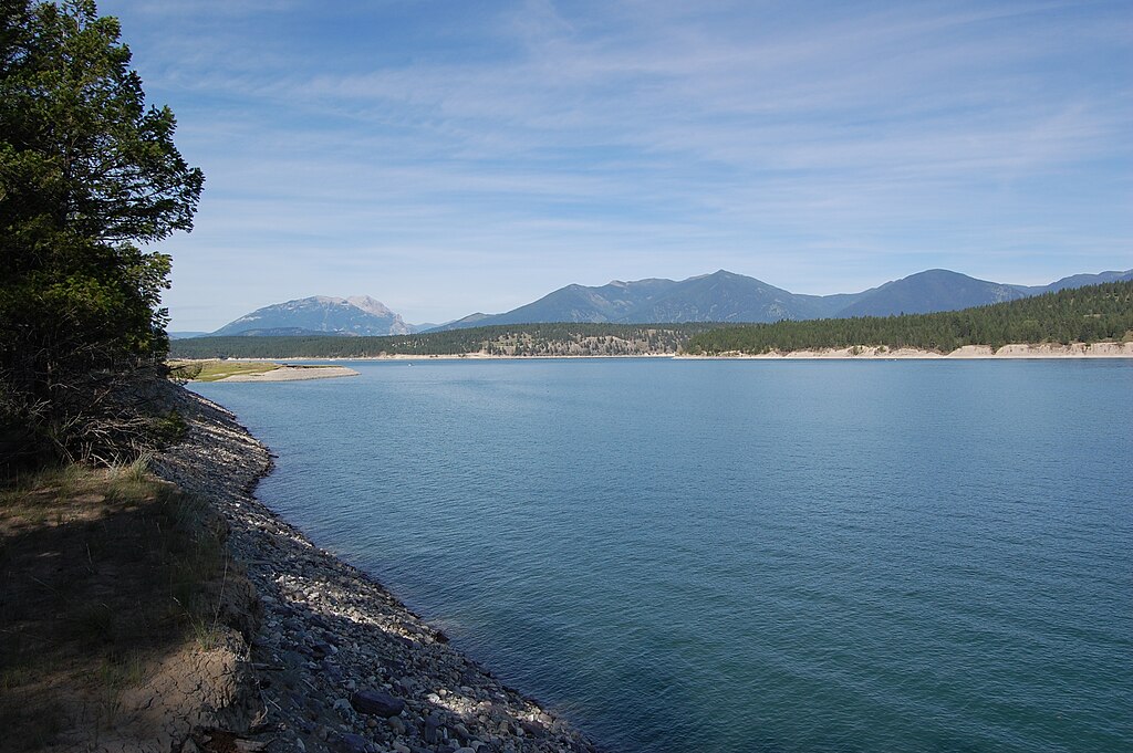
Rexford lies in one of the most enchanting and beautiful regions of Montana. Tiny Rexford is tucked away on the shores of beautiful Lake Koocanusa in the dark, dense, northwest corner of Montana.
Rexford was founded in 1966, but construction of the town began back in 1901 when the Great Northern Railway was cutting its line through northern Montana on its way to Fernie, British Columbia.
Rexford is one of the smallest towns in Montana, occupying roughly 0.10 miles2 (0.26 km2) of land in Lincoln County.
If you’re passing through, stop in Rexford, stretch your legs, breathe in the fresh mountain air, gaze up at the forested hillsides, and take a swim in beautiful Lake Koocanusa.
Did you know? The Pacific Northwest Trail (PNT), a 1,200-mile (1,900-km) hiking trail that stretches from Montana’s Continental Divide to Washington’s Olympic Coast on the Pacific Ocean, passes through Rexford.
6. Outlook
Population: 84
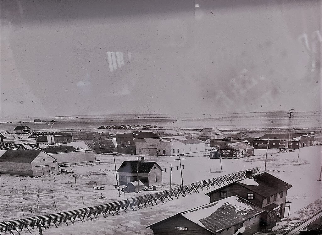
Outlook is a tiny beacon of history in northeastern Montana. Outlook is one of the many towns that sprung up along the lines of the Minneapolis, St. Paul and Sault Ste. Marie Railroad as it cut its way across northern Montana in the early 1900s.
Tiny Outlook occupies 1.30 miles2 (3.37 km2) of land in Sheridan County, Montana.
In addition to the desolate, quiet beauty that surrounds Outlook, this town also offers any visitor easy access to the Medicine Lake National Wildlife Refuge, about 40 miles (64 km) south of town.
Medicine Lake National Wildlife Refuge is a stunningly beautiful natural area that is home to thousands of waterfowl during the summer months. I highly recommend visiting both Outlook and the refuge if you’re in the area.
Did you know? In the 2020 census, not one member of the Outlook population lived below the poverty line.
7. Bearcreek
Population: 91
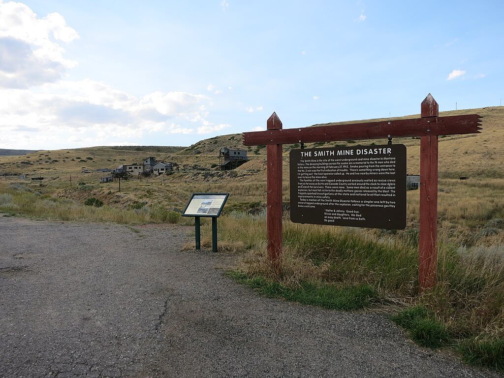
Bearcreek is steeped in the rich mining history of southern Montana. Once a booming coal mining town of about 3,000 residents and many businesses, including billiard halls, a brickyard, hotels, and a bank, today Bearcreek is one of Montana’s smallest towns, filled with mere whispers of a bygone era.
Bearcreek flourished when a direct short line connected the town’s coal mining operations with the Northern Pacific Railroad in 1906. However, the aftermath of the Smith Mine Disaster of 1943 and the subsequent drop in coal demand throughout the 1940s and 50s led to a steady population decline from 3,000 to less than 100.
Today, Outlook sits quietly, occupying 0.12 miles2 (0.31 km2) of land along Highway 308 between the beautiful towns of Belfry and Red Lodge, at the foot of the stunning Beartooth Mountains.
One of the smallest towns in Montana, Bearcreek is well worth a stop if you’re passing through, at least to consider the history of the region and relish in its present-day peace and quiet.
Did you know? In Season 1, Episode 1 of Star Trek’s Strange New Worlds, Christopher Pike lived in a home near Bearcreek before returning to captain the USS Enterprise.
8. Grass Range
Population: 110
The name “Grass Range” speaks to this quaint little town’s important positioin in the early cattle operations of Montana.
The name comes from the fertile range grass that blankets this region of Montana, which local ranchers and farmers have long used for grazing large numbers of cattle.
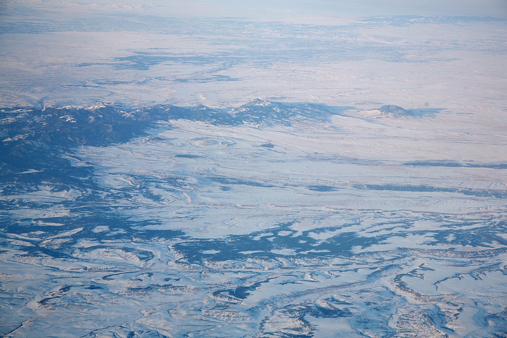
The quaint, quiet little town of Grass Range occupies roughly 0.15 miles2 (0.39 km2) of land in Fergus County at the feet of the Snowy Mountains, just east of historic and beautiful Lewistown.
The town’s current post office has been in operation since 1883. Today, there is a church, several shops, a Conoco, and a high school.
Did you know? Grass Range is surrounded by three stunning wildlife refuges – Lake Mason, War Horse, and UL Bend – all within a 30-minute drive.
9. Judith Gap
Population: 110
Judith Gap, one of Montana’s smallest towns, occupies a 0.38 mile2 (0.98 km2) piece of land in Wheatland County, nestled in the historic gap between the Little Belt Mountains and the Big Snowy Mountains.
The town is named after Captain William Clark’s (from the Lewis & Clark Expedition) fiancee, Julia (Judith) Hancock.
The gap in which this town sits was frequented by the Native American populations of Montana for thousands of years, including Chief Joseph and his Nez Perce tribe on their devastating flight to Canada in 1877.
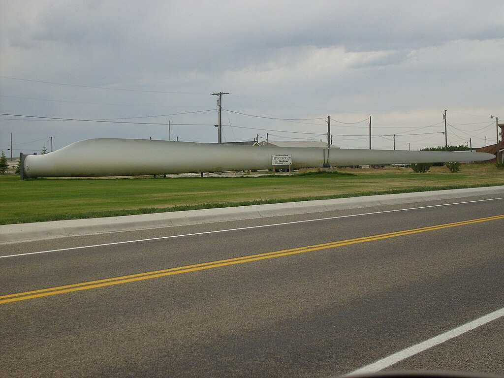
In 2005, Judith Gap harnessed the howling winds that rip through the gap by constructing a wind farm.
Did you know? 90 wind turbines line the horizon in Judith Gap. Each one stretches 262 ft (80 m) into the big sky, is equipped with three 126-ft (38-m) blades, and can produce 1,500 kilowatts of power.
10. Dodson
Population: 125
Quaint, little Dodson is a historic little municipality in north central Montana, along the beautiful Milk River. One of the first establishments in town was the historic post office, founded in 1891.
While Dodson occupies merely 0.19 miles2 (0.49 km2) of territory in Phillips County and is one of the smallest towns in Montana, there is plenty to do here.
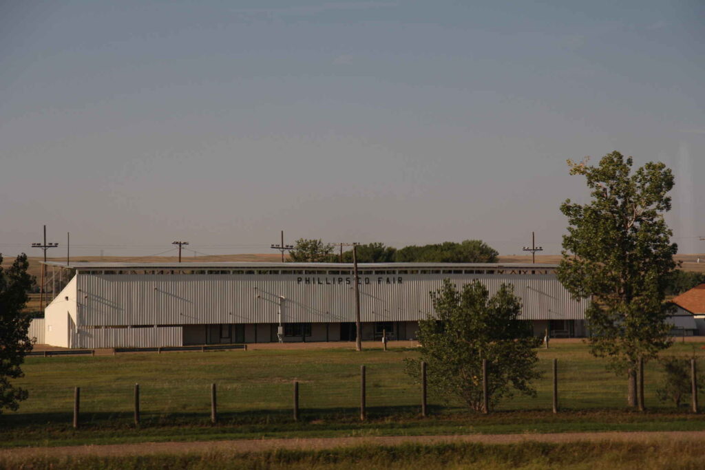
Come to Dodson and enjoy the Philips County Fair, a cultural celebration for rural Montanans of the region that has been running for over 100 years. Or explore the nearby Fort Belknap Indian Reservation, home to the Gros Ventre and Assiniboine Tribes of northern Montana.
The reservation offers guided tours to the devastatingly beautiful Mission Canyon, Snake Butte, Bear Gulch, and St. Paul’s Mission.
Did you know? Dodson was named after one of the first merchants of the town, who operated a local trading post before the Great Northern Railroad made its way across this region of Montana.
11. Melstone
Population: 126
Melstone is a town so small out in the depths of the eastern Montana prairie that if you blink you might miss it. But if you did, you’d be missing out on another town that contains a small, but important, piece of Montana railroad history.
Melstone is another of the towns that popped up along the railroads that were climbing their way across Montana in the early 20th century. Originally established as a base for crewmembers working on the Chicago, Milwaukee, St. Paul and Pacific Railroad, farmers and ranchers also settled here in hopes of utilizing the land.
While the land proved to be less fertile than they hoped, oil production, ranching, and farming together have kept Melstone and the surrounding region alive since the railroads were abandoned in 1980.
Melstone occupies 0.69 miles2 (1.79 km2) of land along the beautiful Musselshell River in Musselshell County, Montana.
Did you know? The railroad’s president and his daughter were traveling the railroad, naming towns along the way. They named Melstone after Melvin Stone, an Associated Press reporter who was traveling with them.
12. Hingham
Population: 131
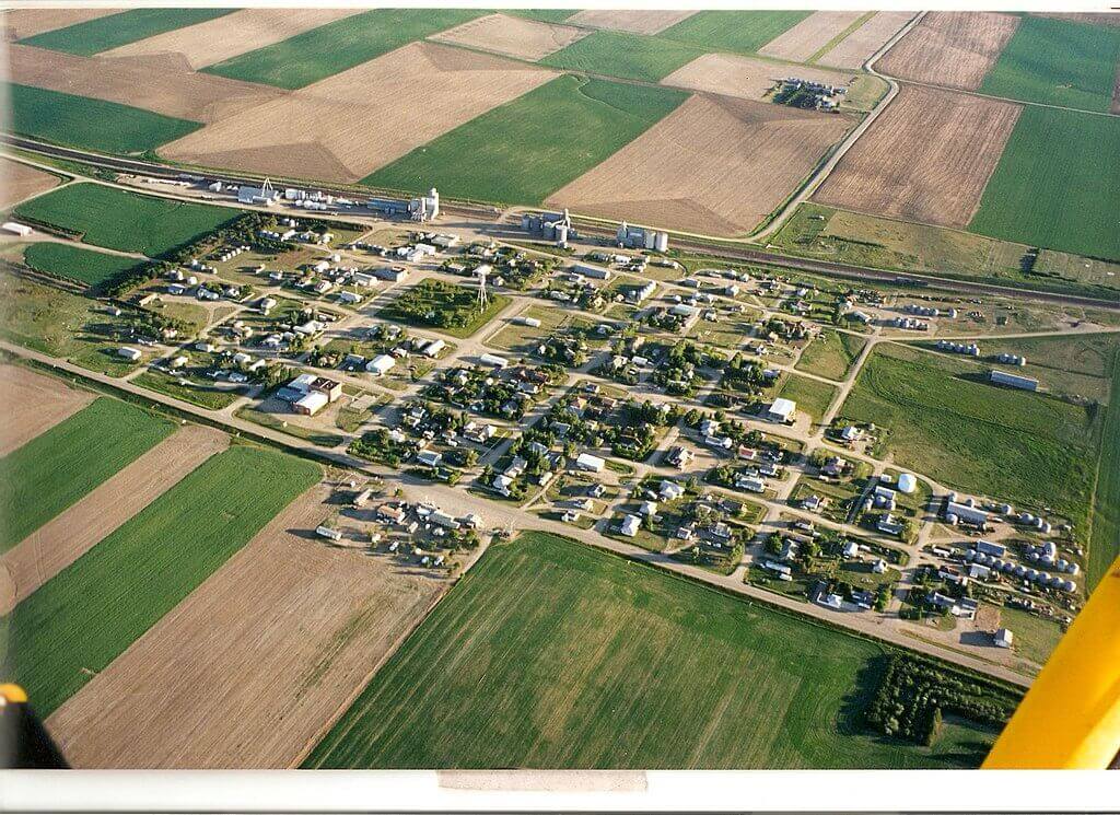
Hingham is another of the gem towns that popped up along the Great Northern Railway route across Montana at the beginning of the 20th century. Today, it bristles with enough energy to keep the town going, though not without challenges.
Established in 1910 as a storage and shipping center on the railroad, Hingham slowly and steadily turned into a bustling community. Today it lies along Highway 2, a historic route for motorists running across northern Montana.
Hingham’s most notable feature is its beautifully designed central square, which has been developed to be one of the top parks along the Hi-Line.
[The “Hi-Line” is the railroad that runs between Havre and Whitefish in northern Montana, but the term is often used to refer to this general area of northern Montana – a beautiful and often overlooked region.]
Hingham occupies 0.17 miles2 (0.44 km2) of land in Hill County.
Did you know? This region of northern Montana was covered by glacial ice sheets roughly 150,000 years ago. At one point, mammoths called this area home.
13. Lavina
Population: 136
Lavina is another one of Montana’s smallest towns that also holds a piece of regional history. Lavina is located in the heart of farming and ranching country in central Montana, just 45 miles (72 km) north of Montana’s largest city, Billings.
When pioneer T.C. Power created an overland stage route to connect his holdings at Fort Benton in northwest Montana to the railroads in Billings, he established a small, bustling stage stop in 1882 along the Musselshell River.
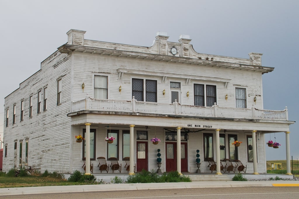
The stagestop was incorporated as a town in 1920. Today, that town is called Lavina, a small, but bustling community of 136 people on a 1 mile2 (2.59 km2) piece of land in Golden Valley County. If you’re passing through, stop to see the beautiful, historic Adams Hotel, dating back to 1908 (above photo).
Did you know? Three sites in Lavina are listed in the National Register of Historic Places: the Lavina State Bank, the Adams Hotel, and the Slayton Mercantile Co. building.
14. Broadview
Population: 139
If you’re ever in Billings and you’re looking to get out of town and see one of Montana’s smallest towns, Broadview (as well as Lavina) is worth the quick trip. While there’s not much to see in Broadview, it is steeped in history, like many of the towns that line Highway 3 northwest of Billings.
Broadview is over 100 years old, another one of the many towns that popped up as the railroads were building lines across Montana here in the early 20th century. Broadview received its first post office in 1908 and officially became a town in 1917.
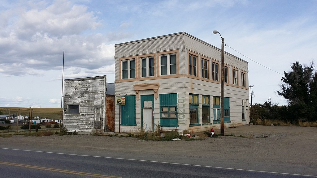
Broadview occupies 0.26 miles2 (0.67 km2) of land in Yellowstone County. The town’s iconic landmarks include its train depot and the former bank building as you enter the town from the south (on the right, after the gas station).
Did you know? Highway 3 from Billings to Lavina serves as a pleasant afternoon drive through a historic part of Montana. The rolling countryside is a pleasure to drive through, and each town along the way is steeped in turn-of-the-20th-century history.
15. Kevin
Population: 154
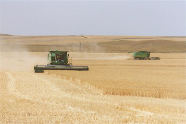
Kevin, Montana, is a small gem of a town in northern Montana, about 20 miles (32 km) from the Canadian border. Kevin occupies 0.36 square miles (0.93 km2) of land in historic Toole County and holds a unique place in Montana history.
Before it became an official town, Kevin served as a watering stop for trains carrying coal along the small gauge Alberta Railway and Irrigation Company Railroad (also known as the Turkey Track), that ran from Alberta, Canada, to Great Falls.
By 1926, Kevin became an official town, and over the course of the following decades, it blossomed. At one point, it had its own bank and hospital. In 1922, oil was discovered nearby, kicking off a thriving oil industry in the area that continues to this day.
Though no longer booming, the quaint little town of Kevin sustains itself today with a post office, café, accountant, barber shop, meat-cutter, and a Senior Citizens Center.
Did you know? Local residents of Kevin pronounce the town’s name with a long “E”, like Keevin.
Discover more Montana towns
10 best places to live in Montana
header image: Robmt1985, CC BY-SA 3.0


